Soil erosion threatens the Sanaga basin in Cameroon

According to a new study, between 1980 and 2023, the area of this major drainage system centered around the Sanaga river, the longest river in the country, has lost 15% of its forest and the size of its cultivated land increased by 94.1%.
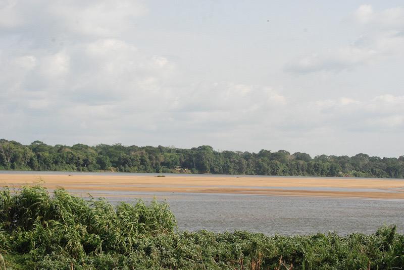
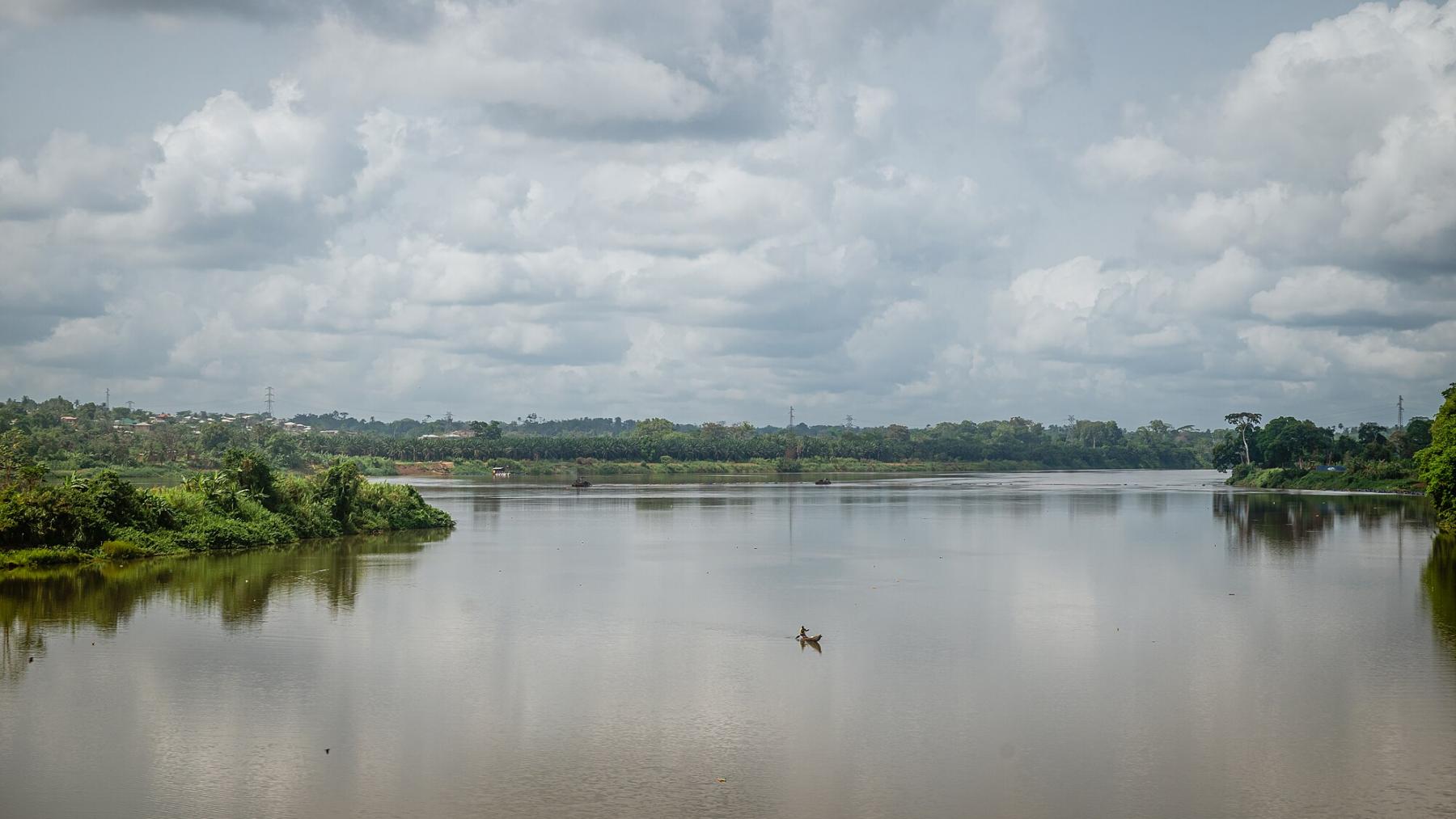
In 1980, the Sanaga basin at Nachtigal, located in the Central part of Cameroon, was a true green paradise. Forest cover was constituting 97.35% of the total area of this major drainage system centered around the Sanaga river, the longest river in the country. 43 years later, the Sanaga basin is dying. Between 1980 and 2023, the area has lost 15% of its forest and more than 33% of the basin’s region has experienced intolerable soil loss, according to a new study published in Environmental Monitoring and Assessment.
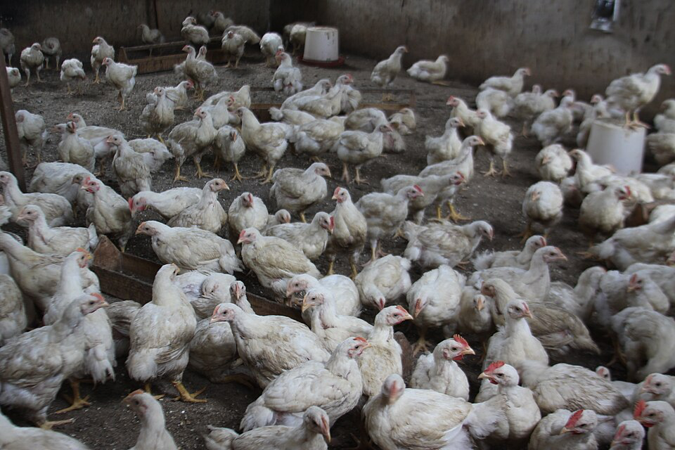
”Over the years, this forest cover has suffered alarming deforestation, resulting in increasing human pressure,” Henri Zobo Mbele from the department of Earth sciences of the University of Yaoundé I and his five co-authors found. The main factor of deforestation is the conversion of forests into agricultural land, inhabited areas, and bare land. Demographic growth also plays an important role in increasing the demand for land for agriculture and habitat.
For example, the research noted that the area of cultivated land in the Sanaga basin increased “spectacularly” by 94.1%, rising from 66,776.17 ha to 132,912.85 ha between 1980 and 2023. At the same time, the area of bare land “alarmingly” jumped by 221.8% while the size of urbanized lands increased by 1,320.4%.
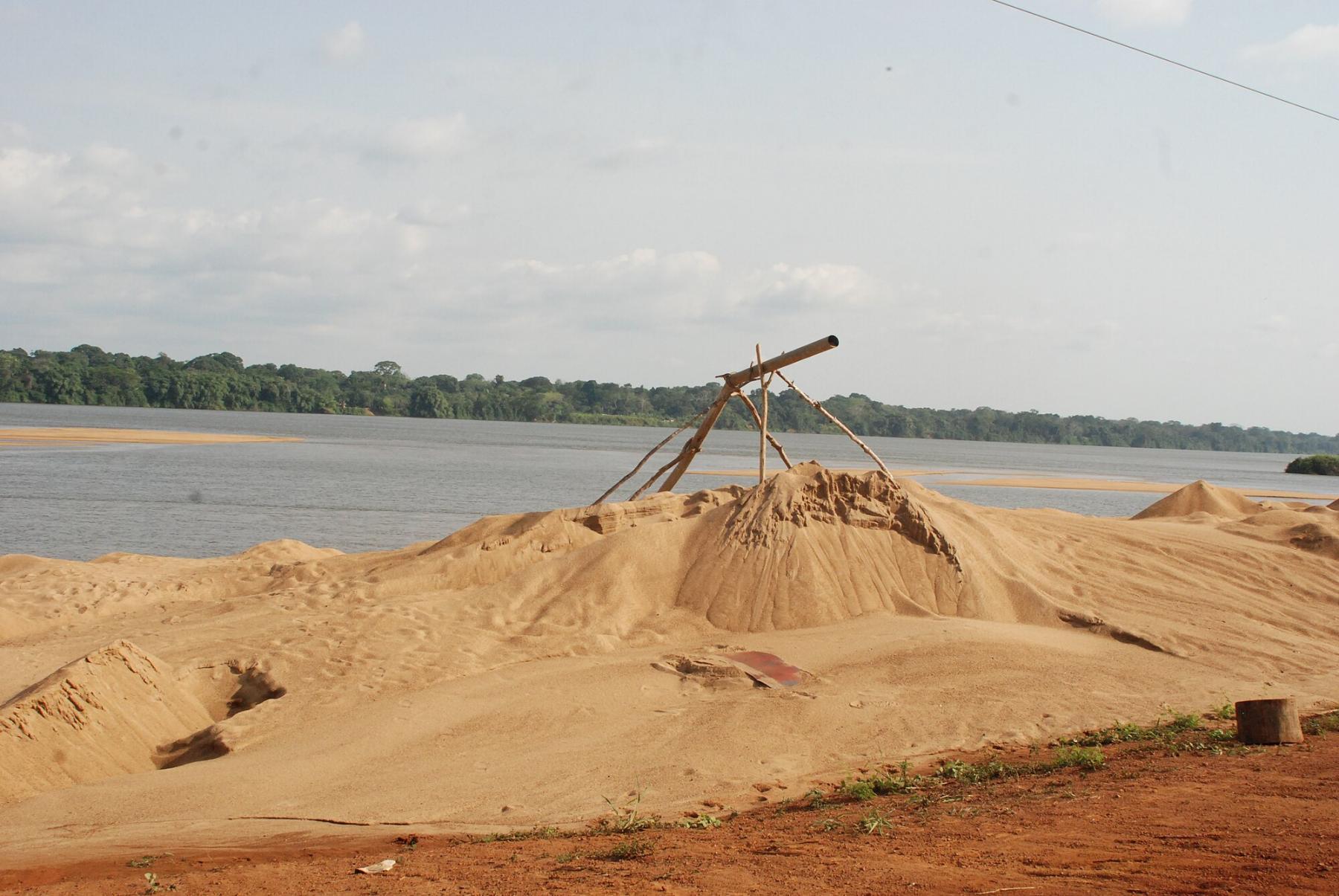
“Gold preservation“
2023 stands out with an average loss reaching its highest level in the studied period, more than double that of 2000 and about four times that of 1980. Surface waters have also experienced a marked increase, rising from 0.34% to 0.75%.
The study explained that this expansion of water-covered areas can be attributed to several factors, including the construction of retention and hydroelectric dams, the development of water catchment sites for irrigation and the creation of water bodies in the gold mining areas of the Betaré Oya and Batouri regions.
Between 1980 and 2010 for example, the research noted that different land use classes showed little change, which can be attributed to limited pressure on the area before the implementation of the "gold preservation" project launched by the Ministry Mines in 2007. This project aimed to regulate artisanal gold mining in connection with the construction of the Lom-Pangar dam.
“However, although completed in 2016, this project has caused harmful consequences, notably the flooding of the Betare Oya gold mine, leading to massive deforestation and the fragmentation of natural habitats,” the scientists regretted, highlighting several studies on the subject.
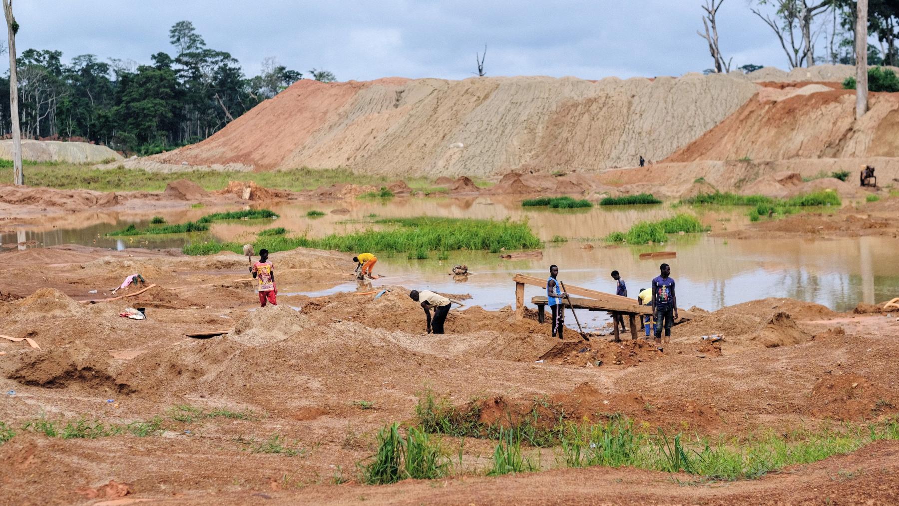
Moreover, the influx of workers attracted by artisanal gold mining has caused a demographic boom in the region, accompanied by agricultural development. “In the Sanaga basin at Nachtigal, the reduction of vegetative cover is mainly due to the expansion of agricultural areas, mining activities, and urbanization,” the researchers wrote. “This urbanization results from the creation of new small towns as part of the government’s decentralization policy.”
The RUSLE model
Water erosion in the region is then the result of a complex combination of factors. Irregular and intense rains, rugged and sloped terrain, insufficient vegetation cover, inadequate agricultural practices such as overgrazing and poorly designed terraced farming, deforestation for firewood or agriculture, as well as urban expansion and infrastructure, all significantly contribute to this phenomenon.
To accurately map and validate this soil erosion by water in the Sanaga Basin, the researchers compared the results of the Revised Universal soil loss equation (RUSLE) model with field data from previously identified eroded plot points, as well as images from Google Earth.
The RUSLE method is a computer program that estimates rates of soil erosion caused by rainfall and associated overland flow. It also offers an estimation of erosion adapted to local specificities. The formula incorporates key factors such as climate, rainfall erosivity, soil type, slope, topography, and land use.
To evaluate the spatio-temporal dynamics of soil loss from 1980 to 2023, the authors used the RUSLE equation which allows the risk of water erosion to be modelled by easily adapting to GIS software and integrates several elements, namely, natural and anthropogenic parameters, which control the operation of the spill in a spilling basin and allow the determination of the rate of soil loss. Their analysis focused on the impact of land use and land cover changes (LULC) on soil loss.
Vegetation cover against erosion
The calculation is formulated as follows: A= R × K × LS × C × P. A represents the annual soil loss rate (t/ha/year). R, the rainfall erosivity factor, is the most important factor in estimating the response of erosion to climate. K, the soil erodibility factor, is defined as soil resistance to erosion and is an inherent property of the soil that depends on its constituents (texture, organic carbon) and structure. The Topographic factor (LS) is the length and tilt of the slopes that affect the production and transport of sediments in space.
In the research, the study area of the plant cover management factor (C) is characterized by five distinct types of land use: forest coverage, agricultural areas (annual crops), bare soil, surface water, and built-up areas. Vegetation cover is considered to be effective against erosion when it absorbs the kinetic energy of raindrops and protects the soil, especially during the period of the year when rainfall is most intense.
The P factor or anti-erosion planning factor reflects the influence of conservation methods on erosion. These include existing anti-erosion cultural practices at a site, such as level curves, alternating bands or terraces, banquet reforestation, buttering, and billoning. These are effective practices for soil conservation and for reducing the intensity of runoff and erosion.
25 high-risk erosion sites
Finally, the Schlaepfer and Bütler method which refers to their 2002 publications concerning ecological traps and their role in biodiversity loss, forest metrics and spatial data analysis was applied to study soil losses and soil occupation types. This formula allows the synthesis of the changes occurring between two dates in a given phenomenon according to its different forms of conversion. In this study, researchers applied the method to two distinct phenomena: soil losses and land use and land cover changes (LULC) types. They crossed the LULC map for each date with the soil loss map for the same date.
During their field trips, the team has identified 25 high-risk erosion sites, located by GPS. The visual analysis of high-resolution satellite images from Google Earth has confirmed the presence of erosion at these sites and has allowed for the identification of new study points, bringing the total to 74 points.
"In order to assess the accuracy of our prediction model, the model’s results were compared to field data,” the researchers said. This comparison was made by cross-referencing the pixels from the inventories with those from the Water Erosion Sensitivity Map, classified into 100 classes.
The authors measured the RUSLE model’s performance of their work through the AUC-ROC, the Area under the receiver operating curve, which is a metric used to evaluate the performance of binary classification models.
The classification has five categories: excellent (between 0.90 and 1.00), very good (between 0.80 and 0.90), good (between 0.70 and 0.80), average (between 0.60 and 0.70), and low (between 0.50 and 0.60). The score obtained by the researchers was between 0.81 and 0.85. ”This high value indicates that the soil erosion map is reliable and accurate,” the scientists wrote.
Sustainable agricultural practices
But despite this validation, the team noted that it is imperative to implement sustainable agricultural management practices, such as conservation agriculture practices on farms (CAP), water management, agroforestry systems, vegetation cover restoration, and the creation of terraces on slopes.
These measures will help preserve soil health and ensure the sustainability of agricultural systems in the basin. ”If the trend of converting forest lands into agricultural lands continues, the risk of erosion will increase, thereby compromising the sustainability of agricultural lands for crop production, especially on steep slopes,” they concluded.
Josiane Kouagheu